- GEAR
- SPARE PARTS
- Backcountry Kit
- Pro Backcountry Kit
- Binding Hardware Kit
- Pro Binding Hardware Kit
- LT Bracket
- Snap Block
- ST Bracket
- T1 Heel Rest
- Ankle Buckle
- Toe Buckle
- Ankle Ladder
- Toe Ladder
- Ankle Adjuster
- Toe Adjuster
- Vert Pucks
- Stainless Steel Pin
- Mini Puck Alignment Guide
- Puck Alignment Guide
- Spark Skin Trimmer
- BINDING TECH
- FAQs
- DEALERS
- TEAM RIDERS
- CONNECT
- ABOUT US
- CONTACT US
Dedicated to pushing innovation in splitboarding since 2006.
866.725.2085
Email: sales@sparkrandd.com
Spark R&D
P.O. Box 3284, Bozeman, MT 59772 USA
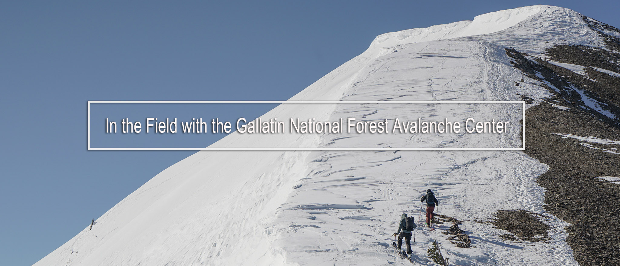
In the Field with the Gallatin National Forest Avalanche Center
Words and Photos: Dan Ventura
It’s 8:50 on a Saturday morning in late March. I’m sitting next to Alex Marienthal, a forecaster with the Gallatin National Forest Avalanche Center (GNFAC), in a white government SUV and we’re heading north out of Bozeman on our way up to Bridger Bowl. Our plan is to use the lifts to gain the ridge and then head south toward Saddle Peak into the backcountry adjacent to the resort.
The GNFAC is a tremendous resource for our backcountry community and I’m stoked they’re letting me spend a day in the field with them. As an active reader of the daily avy forecasts the Center puts out, I’m pretty interested to see how the cake is made, as they say. I mean, I have an idea, I know they’re in the field gathering data and then compiling daily avalanche forecasts. But beyond that, I’m a blank slate.
I think my first takeaway of the day actually happened before we were even out the door. In my head, forecasters would go into the office in the darkest hours of the morning, put out their forecast, and then head out into the field. While this does happen sometimes, this would make for some pretty insane days. More often a forecaster, and there are four at the GNFAC, does a field day and then reports the next morning. In hindsight, this makes a ton more sense to do it this way - observe, then report.
The Bridger Mountains, rising 3,000 feet from the valley floor, are bathed in yellow light and flank us to our left. I begin asking Alex the general get to know you type questions first. After all, we’ve met a handful of times, but never really talked beyond pleasantries at various events.
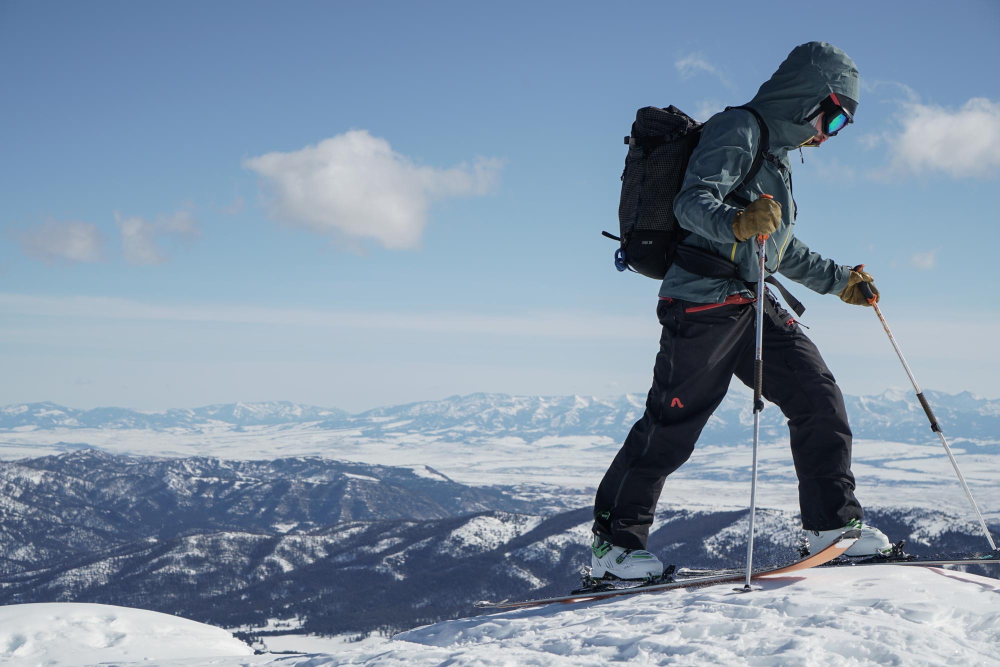
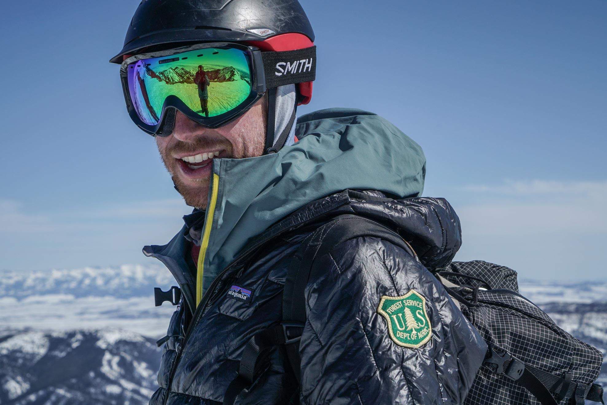
Alex Marienthal on the ridge outside of Bridger Bowl.
“I wanted to ski, I wanted to be in the mountains,” he explains with a smile when I asked how he got into forecasting. He cuts himself off mid-sentence as he drives and scans the mountains, “There’s a little fresh wet slide.” He pauses and regains his train of thought. “Out of high school, I was fortunate to find the snow science program at Montana State and went through that as an undergrad and then into the master’s program.”
He runs me through the science-heavy coursework, the professionals that the program is graduating out into the field, and how lucky he was to get on with the GNFAC. During college, Alex worked with the Ski Patrol at Bridger Bowl and taught avalanche awareness classes for the Friends of the GNFAC, the non-profit arm of the Center. One year after he finished his coursework he had the opportunity to join the GNFAC when Mark Staples, another MSU snow science Master’s graduate, moved to be Director of the Utah Avalanche Center. Today, we’re meeting the GNFAC intern who was in a similar spot to Alex a couple of years ago. He’s currently in the master’s program and with a goal of becoming a forecaster after he finishes his studies.
The GNFAC intern and volunteer for the day is Andrew Schauer. He’s waiting for us at the base area and we immediately jump on a lift. Alex and Andrew begin going through the plan for the day.
“Everyday we’re looking for a specific avalanche problem,” explains Alex. “We have a good idea of what that might be based on the recent weather and conditions. We’re trying to observe this problem so we can report back on where we found it and how people can identify and avoid it.”
When Alex had first mentioned heading out to Saddle Peak I have to admit, I was a bit bummed. Not because it’s not a cool area, it is, I just had thoughts of sledding deep into some remote basin promising sweeping views and a new adventure. I quickly got over this knowing that the lift accessed backcountry off the resort is a super important zone for these guys to cover. Alex mentions, “We go where the people are going in southwest Montana. Sometimes that means deep into mountains in our forecast zone, but frequently, it’s right out the gates at the resort.”
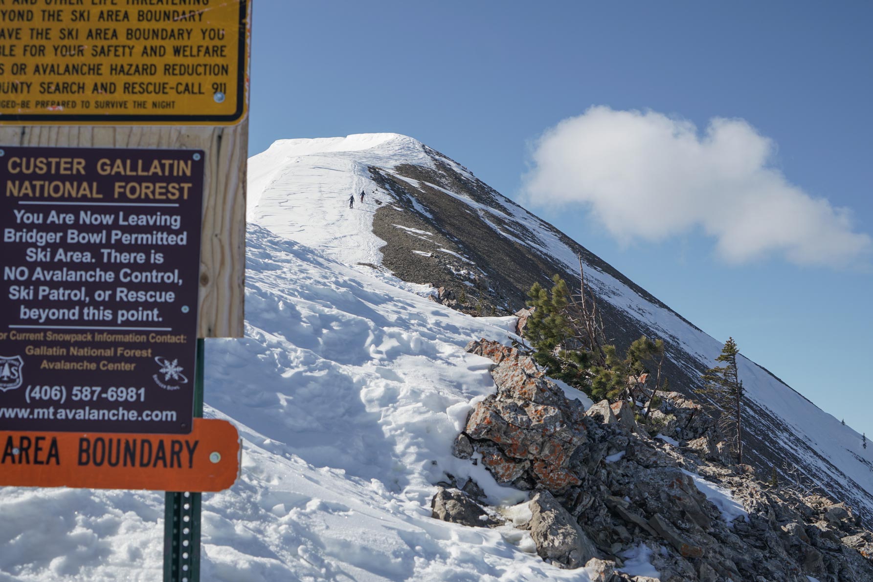

“It’s slide for life up there,” the cautious lift operator informs us as we hop on the Schlasman’s lift that will take us to the top of the ridge. I nod but am already aware. It’s a bit colder out than expected and I had just basically heel slid my way down from the mid-mountain lift to the base of this one. It’s firm.
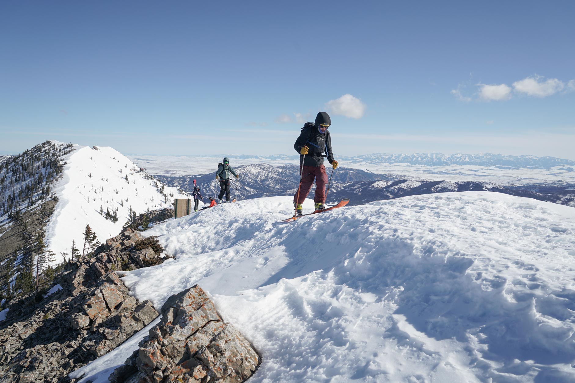
The lift is not open to the public yet, but we check our beacons and head up. At the top Alex pops into the lift shack to let patrol know what we’re doing before we begin our icy traverse south along the ridge and up toward our destination. The morning is crisp and the light still soft as we skin up the north ridge of Saddle Peak, one of the more iconic and accessible summits in the range. Thousands of feet below, Bozeman sprawls across the Gallatin Valley.
The guys beat me to the top and when I reach the peak they’re nowhere to be seen. I snap a couple of photos like a tourist and I’m about to scooch my way toward the edge when Alex throws his arms up over the ridge and climbs up. He and Andrew were both already getting after it and assessing how quick the sun was baking the once frozen snow. It was warming up fast, time to find an appropriate spot to dig and begin gathering data.
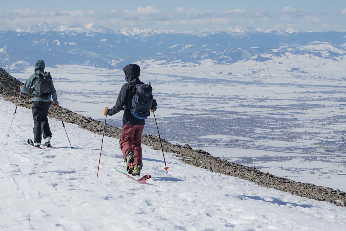
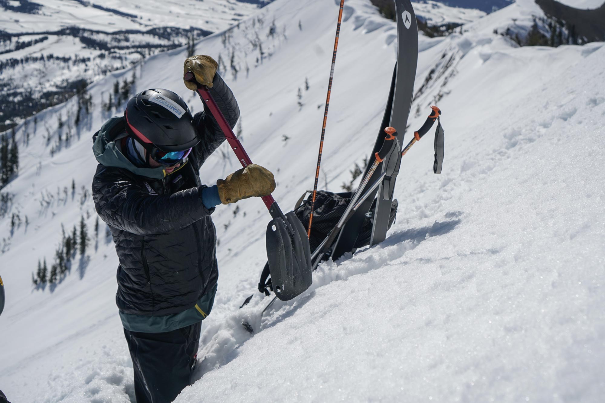
We ride down the ridge into Argentina Bowl, a wide-open snowfield with a few scattered trees that is just south of Saddle. Below the ridgeline Alex finds a spot he likes and the two get to work digging a snowpit.
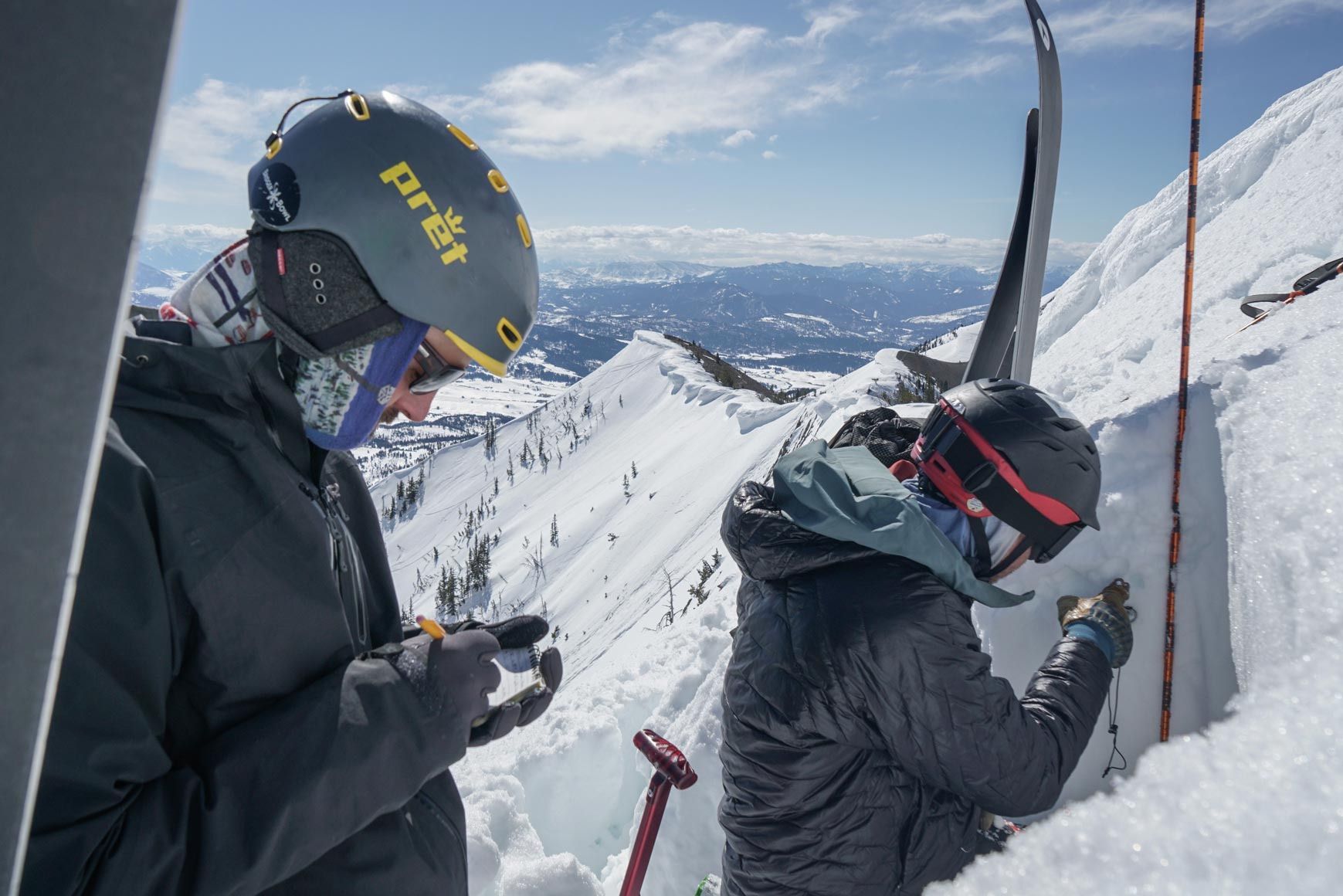
I step off my board and immediately sink up to my hip. This is not blower pow, an hour ago this snow was solid ice; it’s now isothermal meaning the snow is wet and near freezing or 32 degrees F (0 degrees C). I’m thinking back to many of the avalanche safety presentations I’ve attended and the general rule of thumb is if you’re sinking into wet snow past your boot top - it’s time to get off that slope. Well, I’m post-holing down to the pit and they seem unconcerned. Normally, I’d be a bit freaked out but being out with an avalanche forecaster and snow science grad student has a way of calming your avy anxiety. They have assessed our location carefully and have measured the slope angle a couple of times where the pit is dug. They’re comfortable, so I am as well.
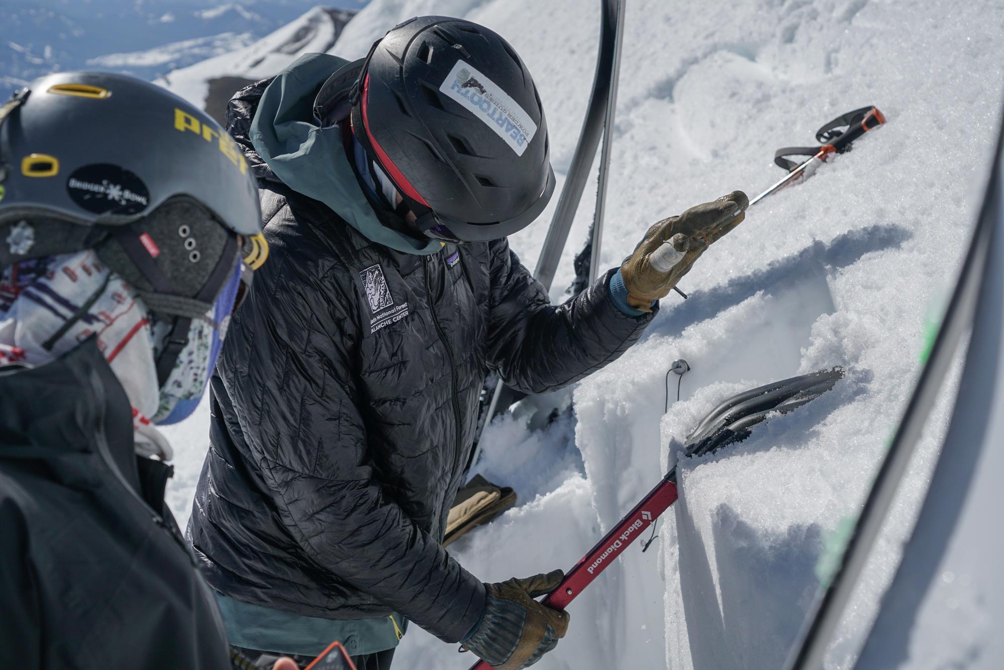
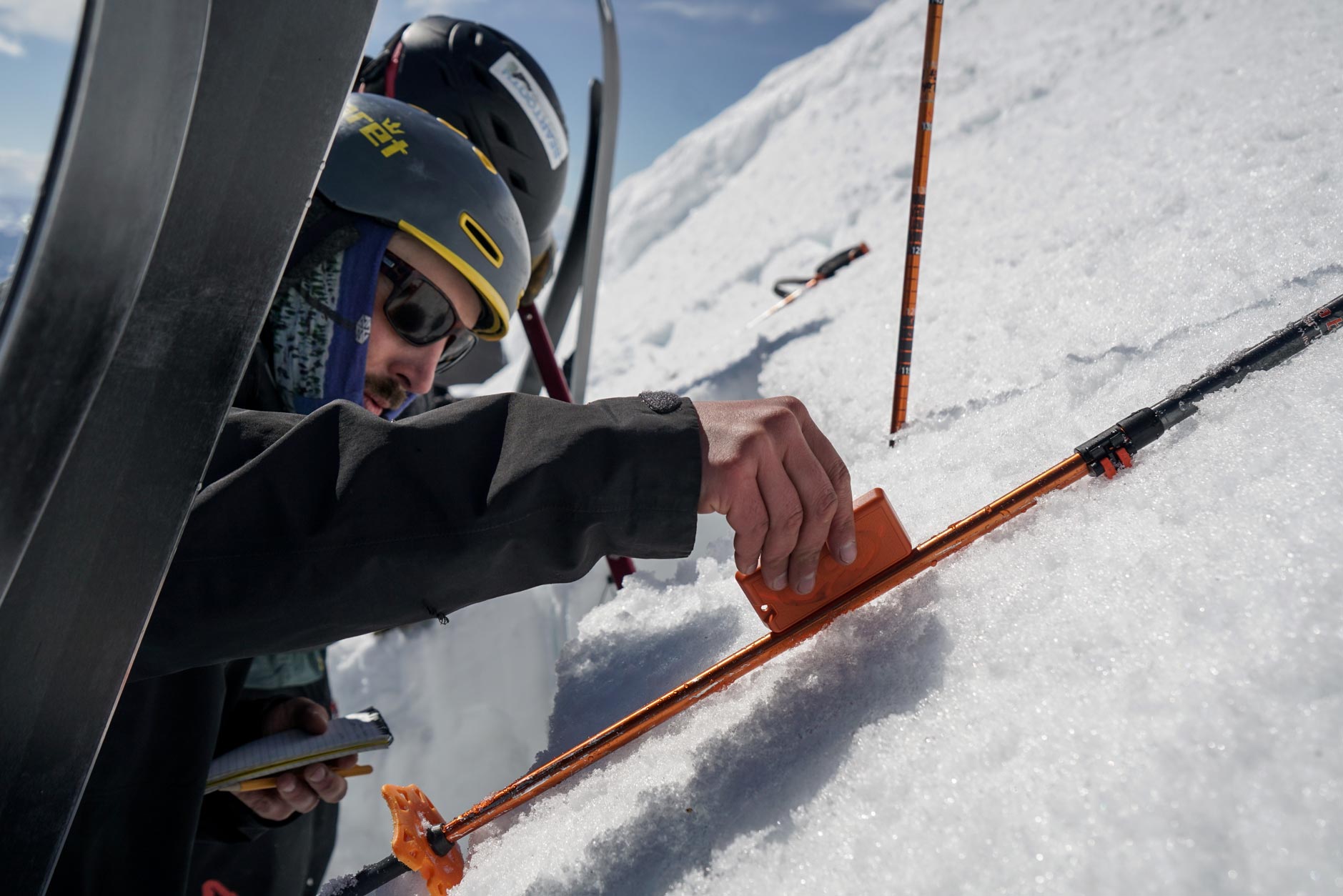
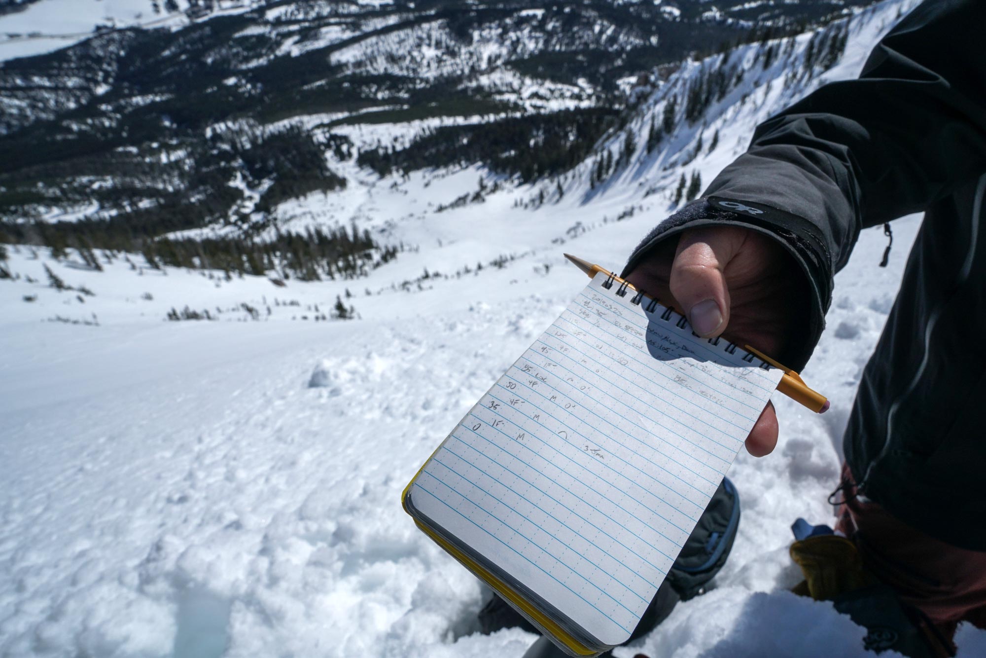
The two get to work like scientists. They’re precise and efficient. They are both making observations but in the actual snowpit, in which there’s only room for one, Alex is doing the testing and Andrew is recording everything. They speak quickly and sparsely in a language that I mostly understand – a dialect of numbers and abbreviations. Alex performs multiple tests to gather the information he needs. Based on the time of year he already has a good idea what’s going on in the snow, but he doesn’t skip any steps.
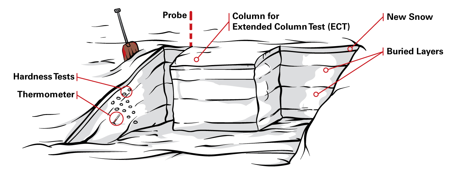
He does an extended column test to look for any funky layers in the snow that could propagate. He prods the side of the pit with his hand observing the hardness of the snow at different depths. He even sticks a thermometer in the snow and takes readings from the top to the bottom.
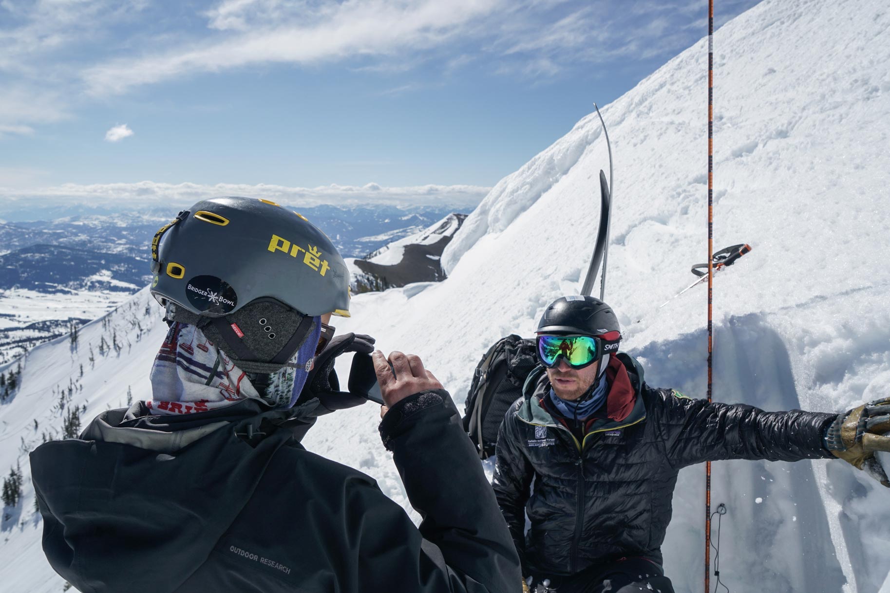
The last step, which is familiar to many followers of the Center, is to shoot a quick video. All this info must get out the public and short videos are one of the best ways to show and explain the current conditions. Alex whips out a smartphone and hands it to Andrew. This makes a ton of sense to do it this way, but it hadn’t occurred to me until now that this is how they shoot the videos I watch each morning.
The first video shot on our field day.
I had to chuckle at a few of the outtakes as we stand on the side of a mountain. I know how hard speaking in front of a camera is, so it was reassuring to see another person fumble through the first couple of tries. Alex gets a take he’s good with after a couple of tries and we’re ready to go. We cave-in the snowpit and push south on the ridge.

It’s warming quickly and I’m struggling to keep up. The once firm ridge is now soft and every third step I’m sinking up to my thigh. Alex and Andrew are not sharing my struggle – with their skis on they can distribute their weight a little better. I debate transitioning my splitboard back to tour mode but decide it's ultimately faster, if not a bit more annoying, to just keep walking.
On the far end of Argentina bowl, we find a northerly aspect with drier snow and drop in. In order to compare the two aspects we’ve been on, the guys shoot another quick video before we actually ski and ride. We make fun if unspectacular turns down to the bottom of the basin. I know Alex and Andrew had fun, but they make it obvious this is work. No high-fives at the bottom, no fist bumps, just a mild acknowledgment that the descent didn’t suck.
There’s a long traverse back to Bridger Bowl - it’s annoying on skis and pretty crappy on a snowboard. We make it though. My day is done for all intents and purposes, but Alex is headed to the office to edit and post his videos. We make plans for the next morning - so far we’ve only told part of the story. A forecaster goes into the field to make observations, but they need to share those observations with the backcountry users who rely on their forecasts for information.
The next morning I show up at the federal building downtown before the sunrise. It’s dark, cool, and quiet as Alex lets me in the side door. It’s a little past six a.m. but he’s already a couple of hours into his morning routine.
A forecaster’s day starts around 4 a.m. with a fair amount of research and data gathering. Each forecaster uses some of their own preferred websites to look at but they’re all checking roughly the same stuff:
- Weather Stations: stations measure different data, but typically the forecasters are looking at the previous night’s temperatures, wind direction and intensity (very important), and precipitation amounts. There is a handy link on the GNFAC website that takes you to all the southwest Montana station links. https://www.mtavalanche.com/weather
- Forecast Models: a foundational understanding of what kind of weather is coming into the area over the next one to seven days is crucial.
- Observation submissions: the local community submits observations from their time in the mountains. The team values and relies heavily on community observations, thoughts, and photos to help them paint a clear picture of what is happening in the forecast area. https://www.mtavalanche.com/node/add/snow_observation
- The Observation Doc: the GNFAC team uses a well-organized google doc to record all the forecasters’ observations and summaries.
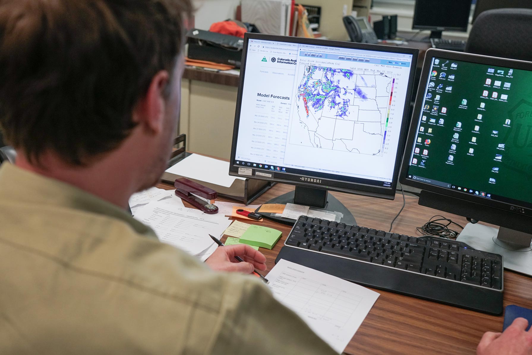
Alex spends a solid hour to an hour and a half each morning he’s in the office simply gathering information as he prepares to write the forecast for the day. Ultimately, the daily forecast is the single most important piece the avalanche center and its forecasters produce. It contains a weather summary, links to current videos from the field, recent avalanche photos or observations, general color-coded danger levels, and most importantly, a snowpack discussion.
The snowpack discussion is broken down into the various regions of the forecast area and covers what avalanche problems readers should be most aware of and where these problems are most likely to be found. It is based on each forecaster’s personal observations, user-submitted observations, and of course, the observations of the other three forecasters which are cataloged in the aforementioned google doc.
“We [the forecasters] are communicating daily about the upcoming forecast and current conditions. Sometimes over the phone, sometimes in person. When conditions change, and specifically, when the danger level rises or lessens, we are all in even closer contact with one another.”
Satisfied with what he has written he dives into the more routine aspects of the early program. He calls into a local radio station to record the forecast summary and makes his own recording for the GNFAC website at the same time. He laughs while admitting that if you don’t get it the first time, it is almost guaranteed to take at least three more tries. I smile remembering my days as a snow reporter where I’d have to record the snow totals for a call-in line every morning. It’s then on to copying and pasting the summary into the proper locations, mainly the website and social channels. As long as the forecast is up by 7 a.m., all is well.
“We have five levels of avalanche danger, green is low, then moderate, considerable, high, and extreme. When conditions in our forecast area or specific ranges in our forecast area reach high levels of avalanche danger, we’ll issue an avalanche warning through the National Weather Service. This amplifies our voice and helps drive home the urgency and dangerous conditions that currently exist in avalanche terrain.”
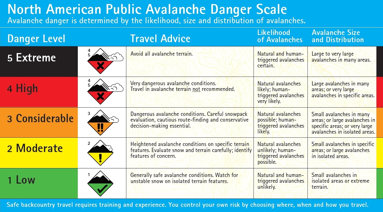
Today, the entire forecast area has a rating of low. The spring can bring more general snow stability, but it is not without its own unique problems. Problems that Alex and the GNFAC team are constantly looking for and explaining how to avoid to a grateful user base.
The sun filters through the big glass windows as Alex finishes up his work for the morning. He examines his checklist closely. Even after doing the forecast over a hundred times, it’s important to scan the list to make sure nothing slipped through the cracks.
It’s time for second breakfast, a Sunday morning nap, and maybe an afternoon of slushy turns up at Bridger Bowl for Alex. In a few days, he’s headed to Cooke City, the farthest extent of the forecast area and a popular ski/snowmobile-tourism destination. Like he said the day before, the forecasters go where the people are going.
Check out the Spark R&D Podcast for an interview with Alex and the GNFAC's Executive Director, Doug Chabot. If you'd like to learn more about the avalanche center or help support them, visit their website --> https://www.mtavalanche.com/.